
Slope stability analysis determines safe cut and fill slopes for hillside development. Rosenberg Associates applies USACE EM 1110-2-1902 standards to assess global and compound stability for retaining walls and foundations. Slope stability evaluation prevents catastrophic slope failure during grading and construction projects across Southern Utah’s challenging terrain.

Key Takeaways

  • Slope stability analysis determines safe cut and fill slopes for hillside development.
  • Rosenberg Associates applies USACE EM 1110-2-1902 standards to assess global and compound stability.
  • Laboratory and field testing provide the strength parameters that analytical models require.
  • A factor of safety below 1.0 indicates imminent failure, while values above 1.5 represent acceptable margins.

What is slope stability analysis?

Slope stability evaluation assesses whether an inclined ground surface will resist failure by sliding or collapsing. The method applies to soil and rock-fill dams, embankments, excavated slopes, and natural slopes. Without this analysis, undetected failure mechanisms remain hidden until catastrophic movement occurs, threatening structures, budgets, and project timelines.

The analysis is a static or dynamic, analytical or empirical method. Its main objectives include finding endangered areas, investigating potential failure mechanisms, and designing optimal slopes with regard to safety, reliability, and economics. Engineers determine the slope’s sensitivity to different triggering mechanisms, such as heavy rainfall, seismic activity, or construction loading.

What are the primary goals of a slope stability investigation?

Three core objectives drive every investigation. First, the analysis identifies zones where failure probability exceeds acceptable thresholds. Second, it reveals the specific failure mechanism at work, whether rotational sliding, translational movement, or compound failure. Third, it guides the design of slopes that balance safety requirements against construction and long-term costs.

How does soil testing support slope stability analysis?
Rosenberg Associates performs in-house soil testing, hazard identification, and geologic analysis as part of its geotechnical and environmental engineering services. These data feed directly into limit equilibrium and finite element models. Without accurate soil shear strength values, even sophisticated computer models produce unreliable safety factors.

Slope investigation methods range from simple infinite-slope calculations for long, uniform grades to complex three-dimensional finite element modeling for irregular terrain. Earthworks design depends on these outputs to establish cut and fill angles that remain stable through wet and dry seasons. Retaining slope design incorporates the analysis to size walls, anchors, and reinforcement that counteract calculated driving forces. Erosion control slope stability measures, including surface armoring and subsurface drainage, address the shallow failure modes that precede deeper instability. Each application shares the same foundation: a rigorous, site-specific evaluation of the forces resisting and promoting movement.

What prerequisites are needed for slope analysis?

Slope analysis requires defined project parameters before any stability calculation begins. The Washington State Department of Transportation’s Chapter 7 Slope Stability Analysis identifies two foundational prerequisites: determination of stable cut and fill slopes, and assessment of overall stability for retaining walls including global and compound stability for permanent systems and temporary shoring systems.

What site data must be collected before slope analysis?

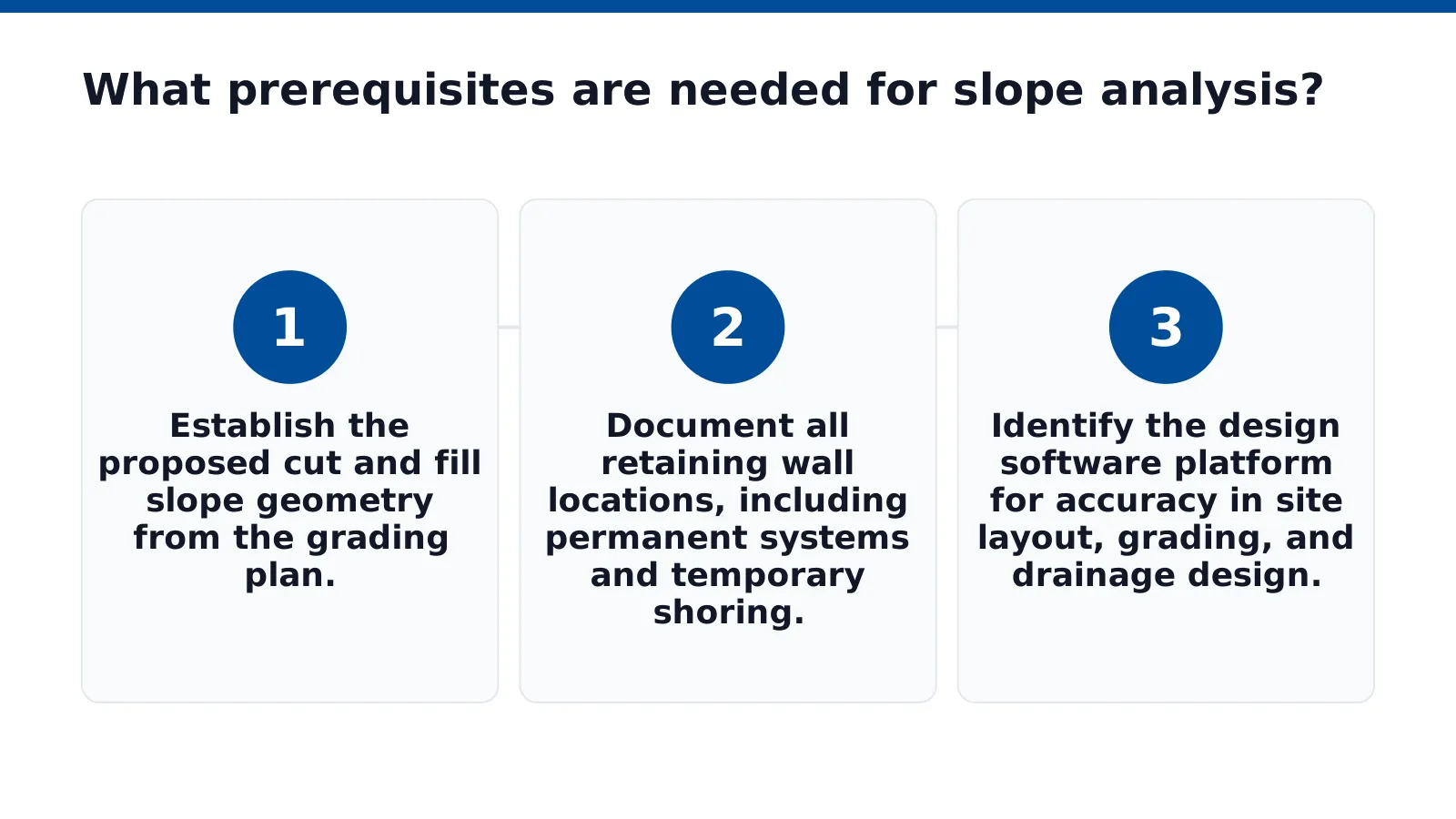
  1. Establish the proposed cut and fill slope geometry from the grading plan.
  2. Document all retaining wall locations, including permanent systems and temporary shoring.
  3. Identify the design software platform for accuracy in site layout, grading, and drainage design.

Rosenberg Associates uses AutoCAD and Civil 3D software for accuracy across these tasks. The firm’s 17-person team in St. George, UT applies this workflow to every hillside and grading project.

How do retaining wall requirements affect slope analysis prerequisites?
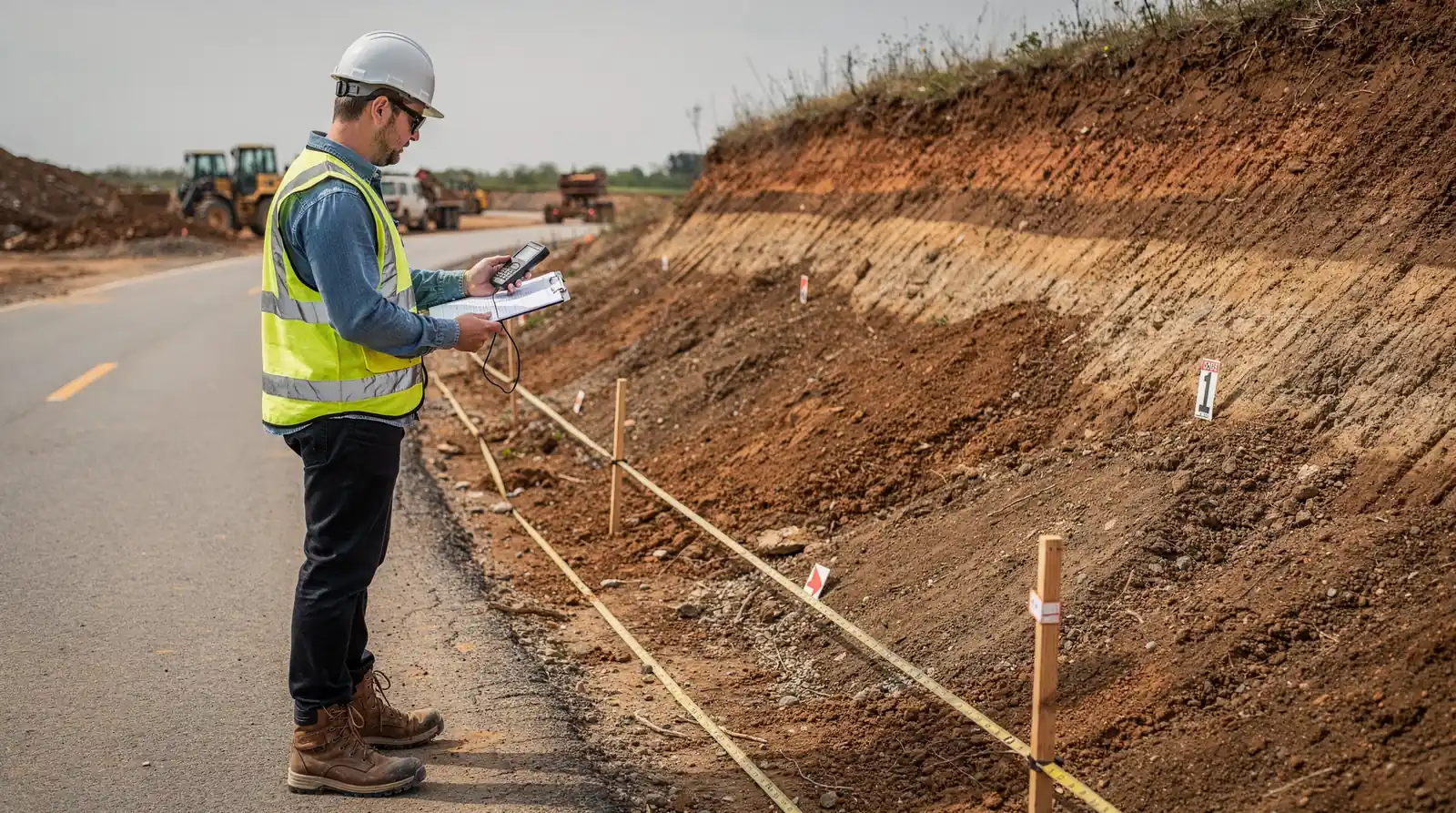
Retaining slope design demands global and compound stability assessment before analysis proceeds. Permanent systems require different loading assumptions than temporary shoring. Missing either prerequisite produces incomplete results that fail during construction or after occupancy.

Stability prerequisites also include erosion control slope stability considerations for exposed cut and fill surfaces. Earthworks design parameters must be locked before analysis begins. Without these prerequisites, the analysis cannot produce reliable factors of safety.

How to calculate factor of safety for slopes?

Calculating the factor of safety for slopes requires dividing resisting forces by driving forces along a potential failure surface. Slope stability is the resistance of an inclined surface to failure by sliding or collapsing. A factor of safety below 1.0 indicates imminent failure. Values above 1.5 typically represent acceptable margins for permanent earthworks.

Slope analysis evaluates equilibrium conditions for embankments, road cuts, excavations, and landfills. The calculation procedure follows a structured sequence.

What inputs are required before calculating factor of safety?

Engineers need soil unit weight, shear strength parameters, pore water pressure, and slope geometry. Site investigation data supplies these values. Missing any input compromises the entire calculation.

Step-by-step calculation procedure

  1. Define the slope geometry, including height, inclination, and stratigraphy.
  2. Select a potential failure surface, either circular or planar.
  3. Divide the failure mass into vertical slices.
  4. Calculate the weight of each slice.
  5. Determine shear strength along the base of each slice.
  6. Compute resisting forces from cohesion and internal friction.
  7. Compute driving forces from slice weight and slope angle.
  8. Divide total resisting forces by total driving forces.

What factor of safety value is acceptable?

The minimum acceptable factor of safety depends on project conditions and consequence of failure. Temporary excavations often accept lower values than permanent slopes. Earthworks design standards specify minimum factors based on loading conditions and design life.

Retaining slope design incorporates the factor of safety into wall dimensions and reinforcement requirements. Erosion control slope stability measures protect the calculated margin by preventing surface degradation that reduces soil strength over time.

Rosenberg Associates applies AACE International’s five-level classification system to cost estimating, which increases in accuracy from preliminary design through tendering. The firm prepares infrastructure construction plans meeting local standards for Southern Utah developers, builders, and municipal managers.

How to design stabilization for complex terrain?

Effective stabilization on complex terrain begins with precise topographic data. Slope stability depends on accurate ground models, and aerial surveys deliver detailed 3D models and high-resolution photos at lower cost than traditional surveying. Rosenberg Associates operates a wide range of drones under licensed pilots, including the Wingtra WingtraOne fixed wing approved by Blue UAS.

Slope analysis for hillside projects follows a structured sequence. Each step builds on the previous one.

  1. Conduct aerial topographic surveys to capture existing ground conditions and identify drainage patterns.
  2. Generate 3D terrain models and orthomosaic maps from the survey data.
  3. Evaluate failure potential using the terrain model, soil properties, and groundwater observations.
  4. Develop earthworks design that balances cut and fill volumes against stability requirements.
  5. Specify retaining slope design elements where grade changes exceed safe natural angles.
  6. Integrate erosion control slope stability measures into the grading plan.

What role does drone mapping play in slope stabilization?

Drones quickly conduct topographic surveys and capture aerial photos for land planning. The data assists with site scouting, road and utility construction, and allotment layout. Fixed-wing and multirotor platforms provide high-accuracy terrain data for drone mapping in Hurricane, Utah and similar terrain.

How does experience affect stabilization outcomes?

Rosenberg Associates brings decades of combined experience across civil, structural, survey, geotechnical, and environmental disciplines. That depth supports informed decisions on complex hillside projects. Project managers apply this expertise to every stabilization sequence.

What common mistakes compromise slope stability?

Slope failures rarely stem from a single cause. Most failures trace back to identifiable errors in slope analysis, design assumptions, or construction oversight. The Washington State Department of Transportation’s Chapter 7 Slope Stability Analysis identifies landslide mechanism assessment as a core analytical function. Skipping that assessment leaves failure modes undetected until movement begins.

Slope stability evaluation must address foundation conditions on or near unstable ground. The same WSDOT chapter specifies assessment of shallow and deep foundations for structures located on slopes or over potentially unstable soils. Overlooking lateral forces applied to foundations produces designs that understate real loading conditions.

What happens when foundation conditions on slopes are ignored?

Structures placed on sloping terrain transfer loads differently than those on flat ground. Lateral earth pressures act against foundation elements in ways that standard bearing capacity checks miss. The WSDOT guidance requires explicit determination of these lateral forces. Without that step, retaining walls and building foundations carry unaccounted stress.

How do construction errors undermine slope designs?

Even sound designs fail under poor construction execution. Rosenberg Associates provides construction engineering that includes material specifications, quality control monitoring, and construction administration. Deviations from specified fill compaction or drainage details compromise earthworks design integrity. Unmonitored construction introduces variables that no design calculation anticipates.

Retaining slope design and erosion control slope stability demand continuous verification. Rosenberg Associates’ work on master-planned communities such as Sunbrook, Sun River St. George, Coral Canyon, and Elim Valley demonstrates how integrated oversight prevents common failure patterns. The firm’s construction administration services close the gap between design intent and field reality.

Common mistakes follow a predictable sequence:

  1. Skip landslide mechanism assessment during preliminary slope analysis.
  2. Ignore lateral foundation forces on sloping sites.
  3. Omit material specifications from construction documents.
  4. Forego quality control monitoring during earthworks placement.
  5. Disconnect design from construction administration.

Each omission compounds the next. A missed mechanism assessment leads to inadequate foundation design. Weak specifications invite substandard fill placement. The result is a slope that fails progressively rather than suddenly, making detection harder until repair costs escalate.

FAQ

What standards does Rosenberg Associates use for slope stability analysis?

Rosenberg Associates applies USACE EM 1110-2-1902 standards to assess global and compound stability for retaining walls and foundations.

What does a factor of safety below 1.0 indicate?

A factor of safety below 1.0 indicates imminent failure, as resisting forces are less than driving forces along the potential failure surface.

What services support slope stability analysis at Rosenberg Associates?

Rosenberg Associates performs in-house soil testing, hazard identification, and geologic analysis as part of its geotechnical and environmental engineering services.

Conclusion

Slope stability analysis and design demand a structured sequence that begins with precise topographic data and ends with construction administration. The factor of safety acceptable for a project depends on failure consequences and design life, but common mistakes (skipping mechanism assessment, ignoring lateral foundation forces, or omitting material specifications) compound into failures that detection misses until repair costs escalate. Applying the full stabilization sequence, from aerial survey through quality control monitoring, closes the gap between design intent and field reality.