
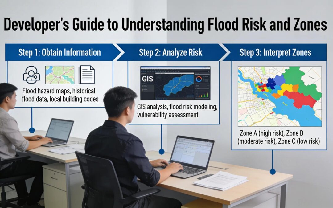
Floodplain Mapping St. George
Floodplain Mapping St. George: FEMA Compliance in St. George, Utah
By Rosenberg Associates Editorial Team ·
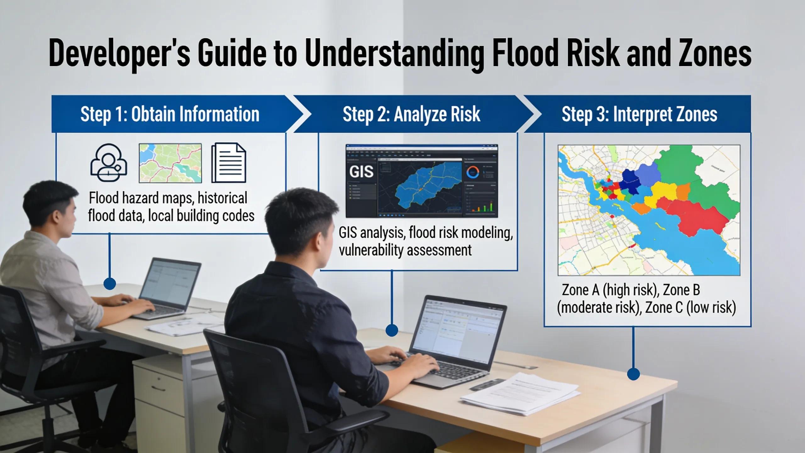
Floodplain mapping and FEMA compliance in St. George, Utah require accurate flood zone determination through FEMA’s Risk MAP program and hydraulic modeling for LOMR preparation. Rosenberg Associates delivers civil engineering services supporting these projects, including grading, drainage design, and utility infrastructure plans built with AutoCAD Civil 3D, ensuring developments meet local regulatory standards.
Understanding FEMA Floodplain Requirements and Risk Data
-
FEMA’s Risk MAP program delivers flood information products and risk assessment tools to Utah communities.
-
Floodplain mapping uses high-resolution data and state-of-the-art modeling for accurate flood risk information.
-
Utah County’s Floodplain Program regulates all designated floodplain activities through development permit processes.
-
Engineers, surveyors, and architects provide critical data for building flood mitigation solutions.
What Will You Accomplish and What Do You Need First?
A successful project outcome in St. George depends on two things: a clear flood risk determination and a permit-ready set of engineering documents. Before construction planning begins, developers and municipal project managers need accurate floodplain mapping data for St. George specific to the parcel in question, since flood zone boundaries shift as FEMA updates regional models. Skipping this step risks stalled permits, redesigned drainage systems, and costly change orders once construction is already underway.
Rosenberg Associates, a locally owned civil engineering firm based in St. George, Utah, delivers floodplain and FEMA compliance Southern Utah services alongside its core civil, structural, survey, and geotechnical disciplines. The firm has built a track record grounded in engineering excellence within the communities it serves.
What documentation should a project team gather first?
Project teams need the parcel’s legal description, existing topographic survey, and any prior drainage studies before requesting a flood risk review. Reviewing community flood maps in St. George early identifies whether a site sits in a mapped Special Flood Hazard Area, which determines insurance requirements and building elevation standards.
Why does terrain complicate flood planning here?
Southern Utah’s terrain creates unusual engineering challenges compared to flatter regions. Soil conditions vary sharply across short distances, and climate swings between mountain elevations and lower desert basins intensify runoff behavior. These factors demand site-specific hydraulic analysis rather than generic regional assumptions.
Project managers should prioritize these early actions:
-
Confirm the site’s flood zone classification.
-
Compile existing survey and drainage records.
-
Engage engineers familiar with local soil and terrain variability.
How Do You Determine Your Property’s Flood Zone?
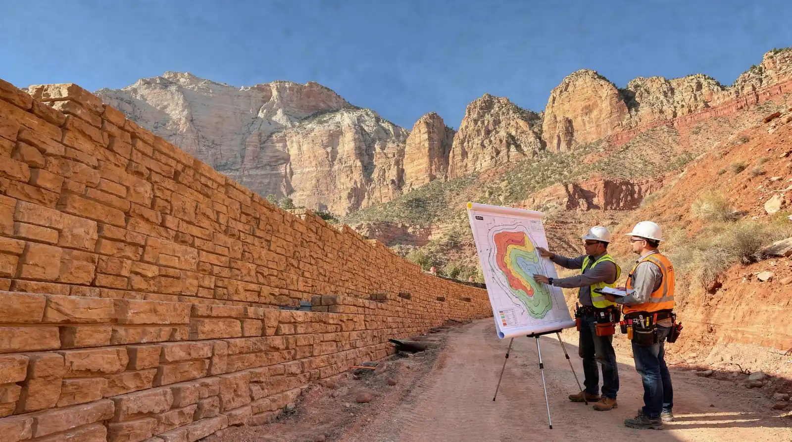
Property owners determine flood zone status by comparing their parcel against official flood hazard maps. If risk appears likely, order a formal survey. Skipping this step carries real consequences: construction in an unmapped or misread hazard zone can trigger permit denials, insurance complications, and costly redesign work in St. George. A structured process, followed in order, prevents these setbacks.
Floodplain mapping for St. George projects relies on layered data, so accuracy depends on following each step before breaking ground.
-
Identify the parcel boundaries and confirm the exact project address or coordinates.
-
Pull the mapped flood risk and zone designation covering that project area.
-
Cross-reference those findings against the FEMA Map Service Center, where current flood maps for the region are published.
-
Flag any discrepancies between older records and updated map panels before finalizing site plans.
-
Engage licensed engineering and surveying professionals to verify boundary and elevation data against the map findings.
What if the FEMA maps seem outdated or unclear?
Older panels sometimes lag behind actual terrain changes, drainage improvements, or new development patterns. When a map appears inconsistent with site conditions, a licensed surveyor should verify elevation and boundary data directly. This confirmation step protects developers from relying on stale data during community flood maps in St George review processes.
Who should verify flood zone findings before permitting?
Licensed civil engineers and land surveyors carry the technical authority to confirm zone determinations. Rosenberg Associates staff includes 12 licensed civil engineers, 2 licensed structural engineers, 3 licensed land surveyors, and a strong support team of project managers, designers, survey crews, and administrative staff who support this verification work alongside project managers and survey crews. That combination of licensure and field experience strengthens FEMA compliance outcomes in Southern Utah for developers, municipal planners, and commercial property owners managing permit timelines across St. George.
How Do You Prepare FEMA-Compliant Floodplain Plans?
Preparing compliant flood plans starts with accurate data, not guesswork. Property owners and municipal planners in St. George who skip proper floodplain mapping risk permit denials, delayed closings, and costly redesigns after submittal. A structured process, built on federal standards and local regulatory knowledge, keeps projects moving.
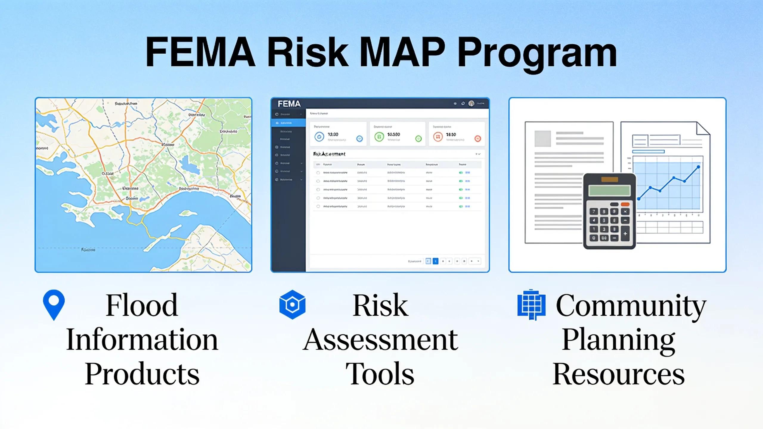
FEMA’s Risk MAP program supplies communities with flood information products, risk assessment tools, and outreach support designed to strengthen local decision-making around flood risk. In Utah, the Utah Division of Emergency Management serves as FEMA’s Cooperating Technical Partner, coordinating the flood data that St. George planners rely on. Any project team pursuing FEMA compliance in Southern Utah should confirm current mapping status with these agencies before design work begins.
What Steps Does the Process Follow?
Developers and civil project managers can follow a defined sequence to produce plans that satisfy federal and local review.
-
Gather existing flood data and confirm zone designations for the project parcel.
-
Cross-reference findings against current community flood maps for St. George to identify discrepancies or outdated boundaries.
-
Model site grading, drainage, and utility layouts using AutoCAD paired with the Softdesk Civil 3D engineering and surveying design package.
-
Draft construction plans that meet applicable local standards and regulations, not generic templates.
-
Submit plans for agency review, incorporating feedback before final approval.
Why Does Local Regulatory Knowledge Matter?
Federal flood standards apply nationwide, but local review criteria vary by jurisdiction. Rosenberg Associates builds each floodplain plan around applicable St. George regulations, avoiding the compliance gaps that generic engineering approaches often create. Consistent brand identification across submittals also helps reviewing agencies track project history and reduces administrative delays during the approval cycle. Precise floodplain mapping in St. George protects both the developer’s timeline and the community’s flood resilience goals.
How Do You Secure Permits and Navigate Local Review?
Securing a floodplain development permit in St. George starts with confirming whether a parcel sits inside a designated flood zone. Any construction, grading, excavation, or other land alteration within that zone triggers a permit requirement before work begins. Developers, property owners, and project managers who skip this step risk stop-work orders and costly redesigns after site work has already started.
Local review exists to protect more than the individual site. The permit process evaluates each project against local, state, and federal standards, a step that keeps a property eligible for federal flood insurance and preserves access to future funding programs. FEMA compliance in Southern Utah hinges on this evaluation. A project judged out of compliance can lose insurance eligibility for the life of the structure.
What Steps Does the Permit Process Follow?
Municipal review generally moves through a predictable sequence, though specific requirements vary by parcel and jurisdiction.
-
Confirm the parcel’s flood zone status using current floodplain mapping in St. George records.
-
Compile site plans showing grading, drainage, and elevation data relative to base flood levels.
-
Submit the development permit application with supporting engineering documentation.
-
Coordinate with utility providers on corridor placement and infrastructure relocation.
-
Respond to agency comments and revise plans as regulatory standards evolve.
Who Handles Utility and Agency Coordination?
Utility coordination often determines how quickly a permit clears review. Rosenberg Associates maintains established working relationships with local utility service providers, an advantage that streamlines corridor planning and reduces back-and-forth during review. That coordination extends to staying current with regulatory agencies, keeping project designs viable while respecting the terrain features that define the region. Firms without this history of community flood maps in St. George and agency familiarity often face longer review cycles and repeated resubmissions. Consistent brand identification across every submitted document further reduces confusion during multi-agency review.
What Mistakes Should You Avoid During Compliance?
Rigid design decisions cause the most costly compliance failures in St. George flood projects. Developers who lock plans too early often ignore field conditions that shift once construction crews break ground. Successful outcomes depend on treating floodplain mapping st george as a living reference, not a one-time checkbox.
Static thinking creates the first major error. Coordination between design teams and construction crews must extend past the drawing board. Field conditions frequently demand last-minute changes to grading, drainage routing, or material selection. Projects that skip this ongoing dialog risk permit delays and rework.
A second mistake involves ignoring input from municipal reviewers. Flexibility and a willingness to incorporate new ideas during design produce stronger outcomes for both developers and the surrounding community. Teams that dismiss agency feedback early often face redesign costs later.
Why Does Jurisdictional Coordination Matter So Much?
Drainage rarely respects property lines. Multi-jurisdictional flood control challenges require direct coordination with local governments to protect people, property, and the environment across shared watersheds near St. George.
Common compliance missteps include:
-
Finalizing site plans before confirming current community flood maps in St. George with municipal planning staff.
-
Excluding field engineers from construction-phase decisions.
-
Treating FEMA compliance in Southern Utah as a single filing rather than a coordinated, multi-agency process.
Consistent brand identification across permit submissions, correspondence, and construction documentation reduces confusion during multi-agency review and speeds approval timelines for developers and municipal planners alike.
FAQ
What is FEMA’s Risk MAP program?
FEMA’s Risk MAP program delivers flood information products. It provides risk assessment tools to Utah communities, using high-resolution data and state-of-the-art modeling for accurate flood risk information.
What documentation should a project team gather before requesting a flood risk review?
Teams need the parcel’s legal description, existing topographic survey, and any prior drainage studies. Reviewing community flood maps early identifies whether a site sits in a mapped Special Flood Hazard Area.
Who provides floodplain mapping and FEMA compliance services in St. George, Utah?
George, with 40 employees, delivers these services alongside civil, structural, survey, and geotechnical disciplines.
Facts
-
Rosenberg Associates is located in St. George, UT, US.
-
Arizona (Page, Littlefield, Scenic, Kingman, Bullhead, Fort Mohave, Lake Havasu City, Prescott, Prescott Valley)
-
Nevada (Mesquite, Logandale, Overton, Caliente, Panaca) With emphasis on grading and drainage plans, land survey, and generically on engineer(ing) / civil engineer(ing).
Conclusion
In closing, floodplain mapping and FEMA compliance represent critical components of responsible civil engineering practice in Southern Utah. Accurate delineation of flood hazards protects communities, informs development decisions, and ensures regulatory alignment. Organizations undertaking projects in flood-prone areas benefit from engaging experienced professionals who understand both the technical requirements and the regional hydrologic conditions that shape floodplain dynamics. Proper compliance safeguards infrastructure investments and community resilience.
Conclusion
In closing, floodplain mapping and FEMA compliance demand rigorous hydraulic analysis, precise documentation, and sustained coordination with regulatory bodies throughout the entitlement and construction process. Southern Utah’s terrain and hydrology present distinct challenges that require an engineering team equipped to address hazard identification, LOMR preparation, and erosion control with technical accuracy. Rosenberg Associates approaches each floodplain project with this disciplined methodology, ensuring community growth aligns with regulatory standards and long-term environmental stewardship at every development phase.